Gallis Circle: SF Redevelopment Proposal —Winter 2023
Skills:
Site Visits + Conditions Analysis
Community-based Design
Land Use Design
Building Massing Design
Road Networks/Artery Design
Base Map Drawings
For this project, I worked on a team of seven to redesign a section of San Francisco, California. The current site is comprised of several underutilized plots of land adjacent to Division Street and underneath the elevated Central Freeway.
Other contributors: Andrew Cha, Dulce’Celeste Martinez, Kaelyn Ong, Sahir Qureshi, Audrey Ward, Henry Zhu
Site Visit + Conditions Analysis
Before starting on our design, my team and I visited and analyzed the conditions of the current site. The left map shows a Google Earth view of the site. The right map is a map I created wherein green represents areas that will change, yellow represents areas that might change, and red represents areas that won't change. Design efforts would go into areas that might or would definitely change.


Big Idea
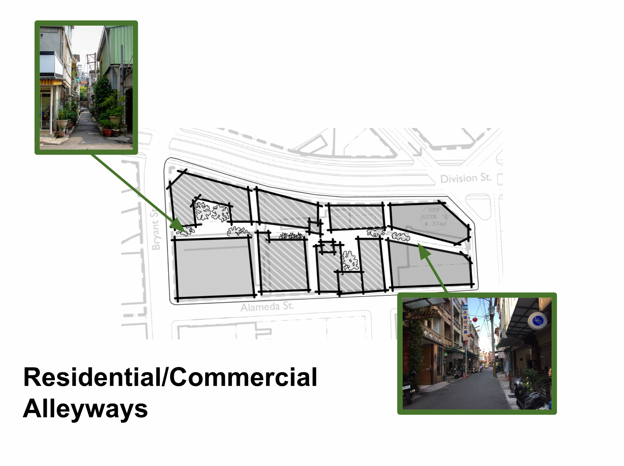
Our team’s proposal focused on a type of new urbanism that is inspired by the evolutionary urbanism and density of European and Asian cities. Through each site, you’ll see the buildings shape this network of narrow alleyways, which are occupied by plants, cafe storefronts, and murals that ultimately work to connect communities.

Zooming In: Designing a Commercial District
I was responsible for designing the central block near the roundabout, wherein I decided to create a mixed-use commercial district. I used a base map to create 1-100 drawings of my design.
Process:

In my initial process sketches, I tried to think about the block’s land use in conversation with the Filipino cultural district to the north and the residential district to the east, while also incorporating an alleyway.

I spent some time refining and testing out a wide variety of building shapes.

After considering the land use of the area, I thought about the massing of the site, as well as the relationship between building height and the open space of the alleyways.
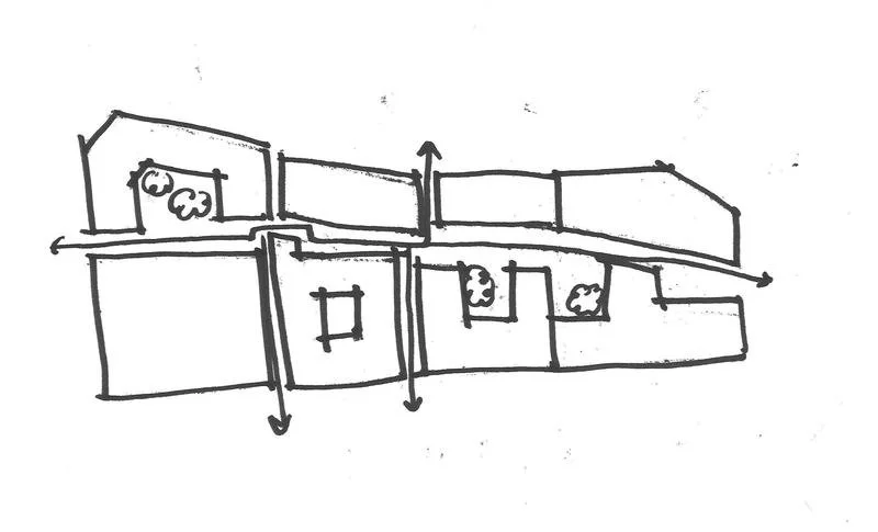
Next, I considered a few options for the alleyway design. I wanted to create a network that would be intuitive, a pathway that would not only create an interesting pedestrian experience but also connect with other districts within the site.

The final design incorporated a massing elements, unique building footprints, a network of alleyways, and lively land use.
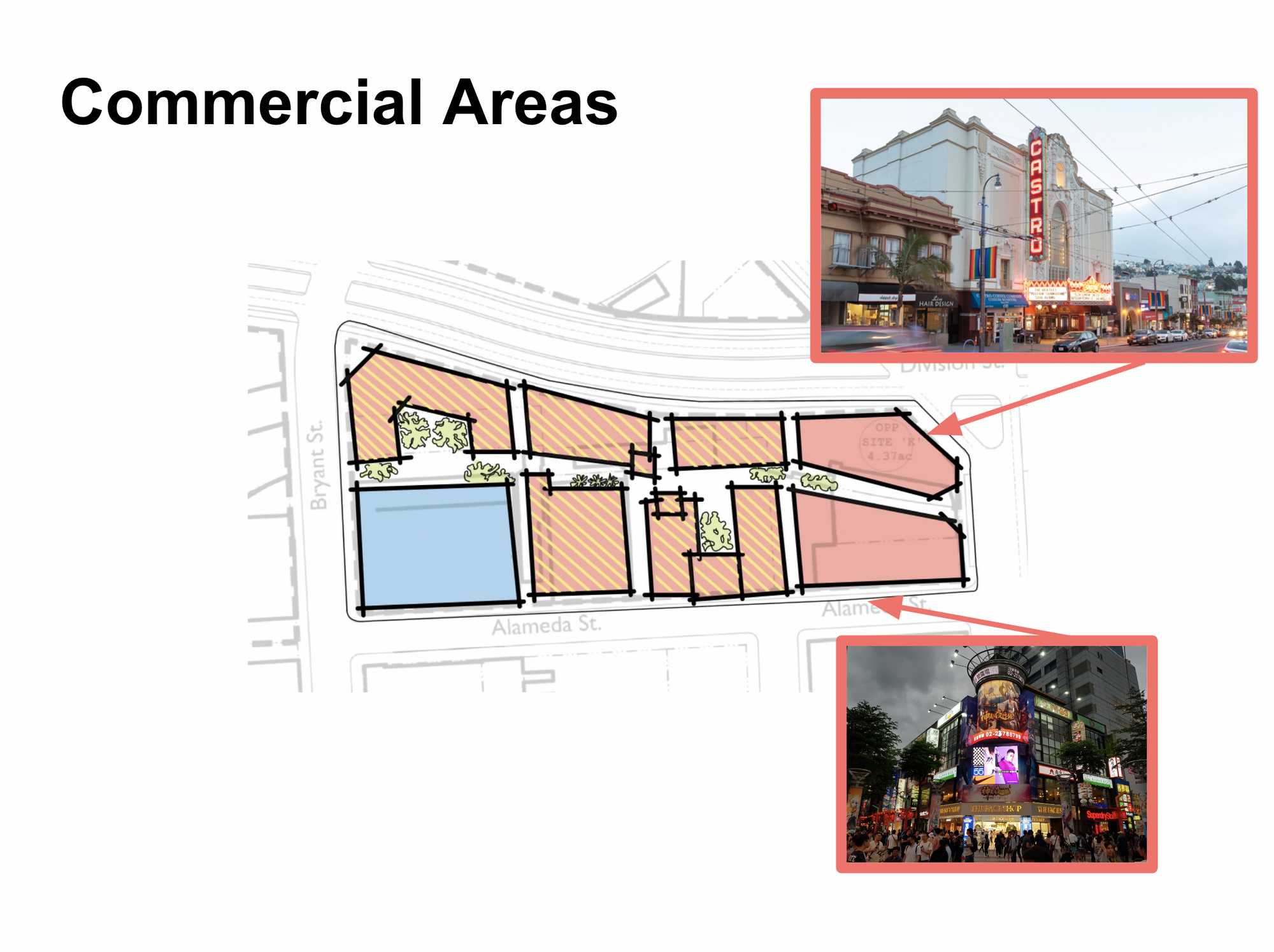
Final Design:
The vision for this district focuses on two central nodes: the animal shelter on the southwest corner, and the landmark theater and commercial area on the eastern side. The theater and commercial area are adjacent to and open up to the roundabout. These nodes are surrounded by a series of high-rise, mid-rise, and low-rise mixed-use buildings with commercial on the first floor and residential on the top floors. Between the buildings, residential and commercial alleyways connect these spaces.